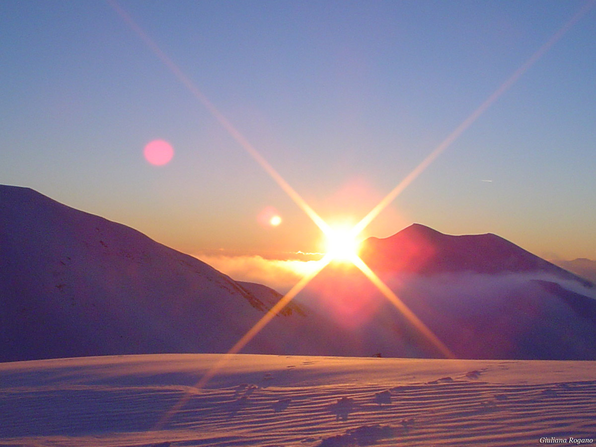


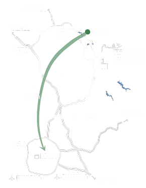


In less than an hour drive from Borgo dei Fiori you can reach the sixth highest peak of the Lazio region, the Terminillo mountain (2217 m). Characterized by a very diverse flora and fauna, Terminillo is the ideal place for excursions and activities such as hiking and mountain races, but especially for skiing.
The Terminillo range is the most important of the four in which you can divide the entire chain of Rieti’s mountains, both for the sports you can practice as well as for their flora and fauna. It consists of a series of peaks separated by deep valleys and elegant ridges. To the east the river Velino separates it with a deep gorge from Giano mountain, and its course delimits the entire south side, while to the west it is limited by the plain of Rieti and from the valley of Lisciano up to the pass of Cantalice, to the north it is limited from the plains of Leonessa.
The history of this mountain began in the second half of the nineteenth century. In 1901 began the construction of the dew Umberto I commissioned by the Rome Ski Club which was completed in 1903. In 1927 the Rieti Ski Club was founded which, in the early 30s, commissioned the construction of the Trebbiani cabin in Pian de ' Valli. It was Mussolini who urged the building of the road and, therefore, the construction of the housing complex Pian de ' Valli. The opening of the road that still runs on the same track today, enjoyed an immediate success which turned Terminillo into the "Mountain of Rome".
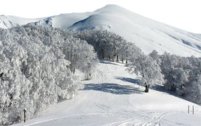
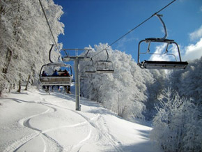
Currently, the Terminillo is among the best equipped winter and summer mountain resorts of Central and Southern Italy. Between 1500 and 2100 meters of altitude there are a cable car, 3 chairlifts and 9 ski lifts, serving about 40 km of slopes, of which 3 are also certified for international competitions. The slopes are excellent for both the beginners and the more experienced skiers. Visitors of the resort can benefit from qualified teachers working in various ski schools. Between 1500 and 1600 meters there are also 26 km of slopes dedicated to cross-country skiing.
2.5 km from the center of Pian de ' Valli starts the plateau of "Five Boundaries", where various tracks cross beautiful beech forests and small valleys, with routes of varying length and difficulty.
There are also hotels of different categories, a modern Conference Centre, a youth hostel, a CAI dew and several apartments that can be rented.
Sono presenti alberghi di diverse categorie, un moderno Palazzo dei Congressi, un Ostello per la Gioventù, il Rifugio del CAI, numerosi appartamenti.
information taken from Comune di Rieti
The Terminillo range is the most important of the four in which you can divide the entire chain of Rieti’s mountains, both for the sports you can practice as well as for their flora and fauna. It consists of a series of peaks separated by deep valleys and elegant ridges. To the east the river Velino separates it with a deep gorge from Giano mountain, and its course delimits the entire south side, while to the west it is limited by the plain of Rieti and from the valley of Lisciano up to the pass of Cantalice, to the north it is limited from the plains of Leonessa.
The history of this mountain began in the second half of the nineteenth century. In 1901 began the construction of the dew Umberto I commissioned by the Rome Ski Club which was completed in 1903. In 1927 the Rieti Ski Club was founded which, in the early 30s, commissioned the construction of the Trebbiani cabin in Pian de ' Valli. It was Mussolini who urged the building of the road and, therefore, the construction of the housing complex Pian de ' Valli. The opening of the road that still runs on the same track today, enjoyed an immediate success which turned Terminillo into the "Mountain of Rome".
Currently, the Terminillo is among the best equipped winter and summer mountain resorts of Central and Southern Italy. Between 1500 and 2100 meters of altitude there are a cable car, 3 chairlifts and 9 ski lifts, serving about 40 km of slopes, of which 3 are also certified for international competitions. The slopes are excellent for both the beginners and the more experienced skiers. Visitors of the resort can benefit from qualified teachers working in various ski schools. Between 1500 and 1600 meters there are also 26 km of slopes dedicated to cross-country skiing.
2.5 km from the center of Pian de ' Valli starts the plateau of "Five Boundaries", where various tracks cross beautiful beech forests and small valleys, with routes of varying length and difficulty.
There are also hotels of different categories, a modern Conference Centre, a youth hostel, a CAI dew and several apartments that can be rented.
Sono presenti alberghi di diverse categorie, un moderno Palazzo dei Congressi, un Ostello per la Gioventù, il Rifugio del CAI, numerosi appartamenti.
information taken from Comune di Rieti
| Facilities | Itinerary | Start | Arrival | Lenght |
| Cableway | Pian dè Valli Terminilluccio |
1630 m | 1868 m | 761 m |
| Chair Lift | Erba Pulita Terminilletto | 1690 m | 2101 m | 833 m |
| Carbonale (two-seater) | 1506 m | 1653 m | 471 m | |
| Cardito Sud (two-seater) | 1587 m | 1763 m | 400 m | |
| Skilift | Campo Togo | 1610 m | 1762 m | 523 m |
| Terminilluccio-(bis) | 1589 m | 1860 m | 816 m | |
| Cardito Nord | 1482 m | 1685 m | 706 m | |
| Scuola di Sci | 1515 m | 1647 m | 418 m | |
| Campo Fiorito | 1634 m | 1680 m | 200 m | |
| Colle Scampetti | 1600 m | 1707 m | 462 m | |
| Anello Campoforogna | 1647 m | 1700 m | 400 m | |
| Est | 1700 m | 1860 m | 563 m |
information taken from terminillo.info
Walking just a few steps out of the town of Pian de ' Valli will enable you to discover landscapes full of high ridges, long valleys, vast beech forests and green meadows. You’ll be immersed in a rich and wild nature and sorrounded by stunning panoramas. Here are some itineraries that will allow you to make the most of your visit.
Itinerary 1:
Pian de ' Valli (1614 m), Cardito mountain (1719 m) and Valle degli Angeli dew (1505 m). Difficulty: Easy, 550 m altitude gap, duration 3:30 hrs round trip This route is one of the most beautiful ones of the east side. The first part (Cardito mountain) offers a splendid panorama of the plain of Rieti. It continues on a trail crossing a beech forest and finally reaching the Valle degli Angeli dew. To return on alternative routes to the one already described you have 2 options: Fonte Acqua Santa Sella di Vall’Organo - Cresta Sassetelli - Vetta. Valle degli Angeli -Terminilletto.
Itinerary 2:
Valle del Sole (1670 m) and Micigliano (925 m) Difficulty: Medium, 745 m altitude gap, duration 4:00 hrs downhill only The Rovara valey is the main focus of this itineray, which is among the most exclusives in the Terminillo range. This valley shows us in fact the wildest side of this mountain. The extensive forests that cover the valley and surround the town of Micigliano are worth a visit, along with the original Museo della Montagna (i.e Museum of the Mountain).
Itinerary 3:
Leonessa pass (1910 m) , Jacci pass (1840 m) and Porcini mountain (1982 m) Difficulty: Easy, 600 m altitude gap, duration 3:00 hrs round trip This route offers views of the north side of Terminillo and Vallonina. We are in the north-west slope of the Rieti mountains characterized by rolling ridges and grassy valleys which bloom and become very colourful in summer. Near Mount Porcini there are two mountain dews used by the shepherds: Maiolica in the north (1704 meters) and Porcini to the east (1562 meters).
Itinerary 4:
Dew A. Sebastiani (1820 m) and Elefante mountain (2015 m) Difficulty: Easy, 200 m altitude gap, duration 2:00 hrs round trip Route with a view that includes both the Terminillo range, as well as the other mountains of the Apennines: the Gran Sasso, the Laga, Sibillini and Velino mountains. Opportunity to continue on the other peaks of the Valloni mountains (more challenging path).
Itinerary 5:
Dew A. Sebastiani (1820 m), Monte Terminillo (2216 m) and Sassetelli ridge (2139 m) Difficulty: Medium, 500 m altitude gap, duration 4:00 hrs round trip The summit of Terminillo is one of the most sought after itineraries. The trail, which from the Sebastiani mountain dew reaches the 2,216 meters of the summit, continues crossing the monumental Sassetelli ridge and is considered one of the most alpine of this mountain .
Itinerary 6:
Lugnano (735 m) and Pian de ' Valli (1614 m) Difficulty: Easy, 850 m altitude gap, duration 2:50 hrs uphill only The town of Lugnano, founded around the year 1000, is located 8 km from Rieti. This route takes you on the south side of the mountain; the first part passes through a mixed forest followed by extensive fields up to Pian de ' Valli. Just above the vilage of Lugnano you can visit the interesting remains of the Convent of St. Rocco.
information taken from terminillo.info